Description

Phu Mu is a small mountain in northeastern Thailand, close to the border with Laos. A long time national forest, it has recently been turned into a national park, but most of the mountain is still outside the controlled area. During the American war, the mountain hosted a US base that was used for communications surveillance of the Vietcong across the river.

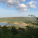
The top of the mountain offers spectacular views over the surrounding plains. It is easy to imagine how back in the 60's elephants could be seen roaming the land from up here and how US servicemen who guarded the perimeter were afraid of the tigers hidden deep in the forest. These days are long gone, and even the wild boar (ภูหมู / phu mu = pig mountain), which once were the namesake of the mountain, have become extinct. Nevertheless, the dense forest is brimming with wildlife, including monkeys, strange birds and poisonous birds. Exercise caution, you have been warned.

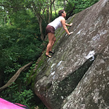
The mountain, like all in the region, is composed of solid sandstone. The top plateau, especially, is of interest, because in many places it breaks off suddenly, offering steep walls and broken off boulders that tumbled into the forest below a long time ago. Accessing these boulders can be difficult due to the dense, thorny undergrowth, the impenetrable bamboo and the tick cover of leaves, under which the snakes hide.

If you do venture into the jungle, however, and you are well prepared - bring a machete and proper shoes, at the very least - you will be rewarded with perfect, unclimbed boulders to last for many more years of exploration and climbing.
History

Development here started in 2013 with the Machete sector, which is close to the road and easy to access. Over the years, many possible sectors have been unearthed, but few lines have actually been climbed. This changed when in December 2021 the big roof of Radar Station was first found and development accellerated.

Phu Mu

The area is access sensitive!

1) Special rules at this crag

Phu Mu is a national park. Climbing in national parks in Thailand is generally frowned upon by authorities, and, when discovered, will typically not be allowed. This puts the climbing at Phu Mu at risk of of closure.

That being said, Phu Mu has several advantages over other national parks:
1. Except for the sector Waterfall, all the boulders are outside the controlled area. Rangers don't typically go here, and there is no control of who goes in and out.
2. Phu Mu is only a national park in name. While there is an entry booth, you don't have to pay entry and there typically is no record of who goes in and out.
3. The area is remote enough that nobody really cares what you do, you are never visible or even audible from the street when climbing and there is very little risk of the area ever becoming overcrowded with climbers.

Nevertheless, follow local rules: You are not allowed to be on the mountain after dark (officially, after 6pm). This is generally advised, as the animals come out in the evening, including snakes. Don't litter, no fires, no loud noise that will disturb wildlife.

2) How to drive to the crag

There is no public transportation in the area. You need a motorbike or car.
From AH121, turn on 3037 at Ban Non Sawang (โนนสวรรค์). Follow over the bridge that crosses the lake. After the bridge you will come to an intersection, straight up goes to a temple. Turn left towards Phu Mu. Follow the road for another 2km or so up the mountain. Sector Machete is to your left about 100m after a sign that says "sharp curve". Park next to the road. For sector Radar Station, keep driving until you see the ruins of a concrete wall to your left (another km or so). Right after the concrete wall is a dirt street that leads to the left. Drive left, park here. Sector Waterfall requires you to drive to the top of the mountain, into the national park. Keep driving after the entrance, and either walk or drive on the path straight ahead further into the jungle.

3) How to reach the sectors on foot

Reaching the sectors on foot is, despite the short access, difficult. For sector Machete, make out the obvious block that is on the left in the beginning of the sharp curve right next to the road. Walk into the jungle to the left of that block. After maybe 50 meters you will find a big slabby boulder. Scramble over it and you will see the little 'canyon' with the boulders.

Sector Radar Station is right below the ruins of the old US surveillance base. Walk towards the edge of the cliff, then turn left for about 100m. Follow the edge of the cliff. As a way marker, there are some boulders to your left that are too small to climb on. Around there, it is possible to walk down over a small talus field and right towards the climbing. The first blocks appear right there.

Sector Waterfall is right at the end of the path. Once you can not drive further, you are there.