🇬🇧
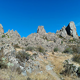
About an hour away from the capital, Ankara, Sivrihisar provides a variety of climbs on granitoids that rise singularly from Anatolia’s moors (i.e., bozkır). While summers in the moors are scorching, shadowy sides of the crags still permit climbing on the available trad routes, and early morning, late evening, or night sessions on boulders provide acceptable conditions. However, the best seasons for the area are the spring and autumn. Dry winter conditions have to be followed closely.
Herds from nearby farms or villages regularly use the pasture in and around the crag. Try to make voice contact with the shepherd before approaching the packs so that the kangal dogs of the herd know that you are friendly.
Do not forget to bring all the water you need in any season. The water in the campsite is not consistent and trustworthy either. The animals use the drinking basin under the fountain, so detergents or soaps should not be used near the fountain. Please don't light a campfire under the walnut tree. This harms its health seriously. This is the only shelter against the sun, especially in summer. Examine the routes for possible nests. Please delay your climb until the residents leave the house, if there is one.
There is a solid consensus among climbers to leave this crag bolt-free. Please respect this decision to reserve the place for the next generation of climbers and their potential traditional gear-protected climbs. We will update the crag with all the existing traditional routes over time. You may run into pitons or old stuck gear on some old routes. Please leave them in place, but use them with caution.
🇹🇷
Erişim:
Sivrihisar kayalıkları Ankara-Eskişehir karayolunun (D-200, E90) yaklaşık 135. kilometresinde, Sivrihisar ilçesinin kuzey ve kuzeydoğu sınırındadır. Ankara'dan gelirken yolun sağ tarafında yer almaktadır. Bölgeye Ankara-Eskişehir arası çalışan otobüsleri kullanarak ulaşabilirsiniz. Otobüsler yol üzerinde Sivrihisar’a 5 km uzaklıktaki TŞOF ya da öncesindeki Can Osman Tesislerinde yolcu indirebiliyorlar. TŞOF (Türkiye Şoförler ve Otomobilciler Federasyonu – Sivrihisar Tesisleri) tesislerine girdiğinizde binaların sağında kalan stabilize yoldan ilerleyip, (39.449811, 31.559316) (https://goo.gl/maps/2LK1H2d9PVbw9Qvi8) koordinatlarına ulaşabilirsiniz. Bu noktaya erişmeden hemen önce sağınızda bir çiftlik evi göreceksiniz. Koordinata ulaştığınızda solunuzda kalacak olan patika ile devam ederek kamp alanına ulaşabilirsiniz. Patikanın girişi kısmen yola dönüştürülmüştür.
Sivrihisar ilçe terminalinden geliyorsanız kayalara ulaşım için kayalıklara doğru yükselen ve kral yolu denilen taşlı yolu ve patikayı izleyebilirsiniz. Yolun girişinin koordinatları şöyledir: Cennet Sokağının sonu (39.448452, 31.544655) (https://goo.gl/maps/CjZregCinQF9Mhab9)
Araçla ulaşımda birden fazla seçenek vardır. Ancak son yıllarda yukarıda TŞOF Tesisleri üzerinden tarif ettiğimiz stabilize yol en kolay ulaşımı sağlamaktadır. Yolda sadece bir noktada ağır yağış sonrası görece derin çamur oluşmaktadır. Bunun dışında standard yükseklikteki araçlarla erişimde bir problem çıkmamaktadır. (39.449811, 31.559316) (https://goo.gl/maps/2LK1H2d9PVbw9Qvi8) koordinatına ulaşıldığında, patika girişinin kısmen yola dönüştürülmüş ağzına ulaşılmış olmaktadır. Aracınızı burada, sağa devam edecek araçların geçişini engellemeyecek şekilde, park etmeniz mümkündür. Buradan sonra kısmen yola dönüştürülmüş kısım yaklaşık 200-300 metre devam edip, patikaya dönüşmektedir. 2022 sonbahar aylarında bu kısmın bir maden firması tarafından uzatıldığı tahmin edilmektedir. Patikanın sonunda (39.452167, 31.554393) (https://goo.gl/maps/DEHBoDGUKbrM7Nxv6) koordinatlarında göreceğiniz ceviz ağacı ve çevresi kamp alanıdır. Araç park yerinden kamp alanına yürüyüş yaklaşık 10-15 dakika sürmektedir.
Araçla ulaşımda kullanılabilecek diğer seçenekleri, yolların güncel durumları takip edilmediğinden tavsiye etmiyoruz. Ancak kabaca ek iki alternatif yoldan söz edilebilir: 1) Ankara yönünden gelirken yine sağda, fakat TŞOF tesislerinden önce yer alan, Can Osman (eski adıyla Tempo) Tesisleri girişinin hemen yanından giren toprak yolda, önce ters yönde karayolunu takip edecek şekilde ilerleyin, ardından yükselip, kıvrılarak sola devam edin. Toprak yolun sol tarafında kalan çiflik evinin (TŞOF tarifinde sağınızda kalan ev) oraya ulaşıp, yukarıdaki tarifteki gibi patikayı takip edebilirsiniz. Ya da evin oradan sağa devam eden yolu izleyip, kamp yerinin alt hizasındaki açıklıkta ((39.452627, 31.556115) (https://goo.gl/maps/abnVCiLwv9vsms3r5)) aracınızı park ettikten sonra kamp yerine yürüyebilirsiniz. 2) İkinci seçenek Ankara yönünden gelirken Böğürtlen Köyü ayrımından (Eskişehir-Anakara yönündeki Muhteşem Tesisleri karşısında) köy yoluna girip, sol tarafa ayrılan toprak yolları izleyerek kamp alanının altlarına gelip, buradan yürümektir.
